
From Pacific Desert Dunes and Alpine Passes to the Primordial Canopy
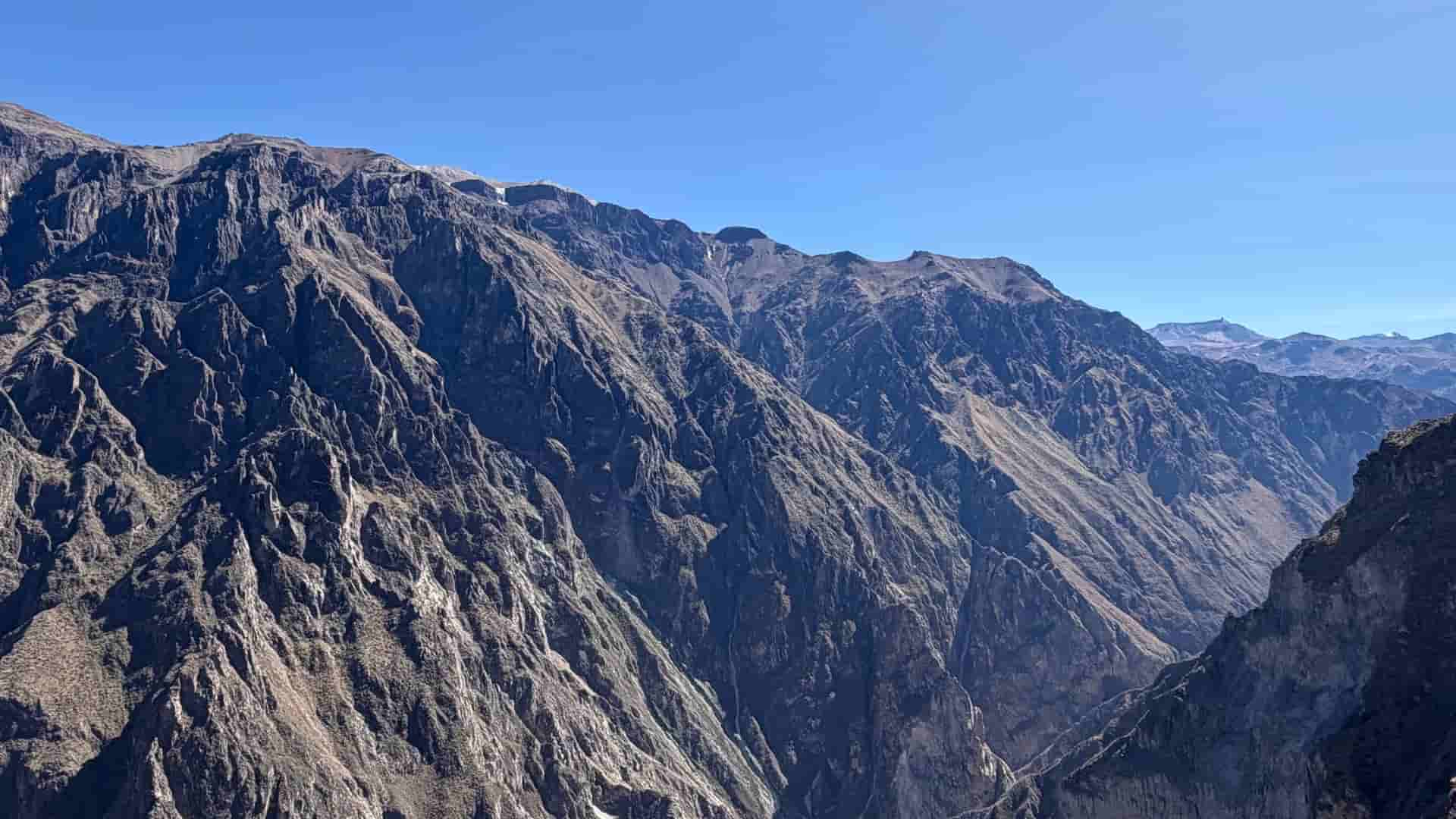
The air at Patapampa Pass cuts like chilled glass at 4,910 meters elevation. Diesel exhaust from the transfer vehicle freezes almost instantly in the violent, thin crosswind off Sabancaya’s smoking volcanic flank. Below us, the earth drops into the abyss of Colca Canyon; above, the atmosphere thins until breath becomes a deliberate, calculated act of willpower. There is no warmth here, only the hard, blinding radiance of the high Andean sun striking razor-sharp obsidian rock and sulfur deposits. Oxygen saturation drops in the blood; the pulse drums violently in the temples. The journey down into the canyon demands total physical surrender before the ascent toward Titicaca even begins.
Geography & The Stakes
Few geographical corridors on Earth force such relentless physical recalibration. This line cuts across three distinct planetary biomes: the hyper-arid Pacific coastal desert, where shifting sand dunes bury ancient geoglyphs; the sheer granite wall of the Central Andes, peaking above 6,000 meters; and the dense, oxygen-heavy basin of the Tambopata rainforest. This landscape does not tolerate structural weakness. The tectonic collision of the Nazca and South American plates created vertical relief so abrupt that human physiology is stretched to its absolute margins within hours. Traversing this terrain requires mastering rapid atmospheric transitions, surviving brutal thermal fluctuations from sub-zero altiplano nights to humid jungle heat, and honoring three millennia of architectural and engineering ingenuity forged under unforgiving ecological pressure.
The Logistics & The Movement
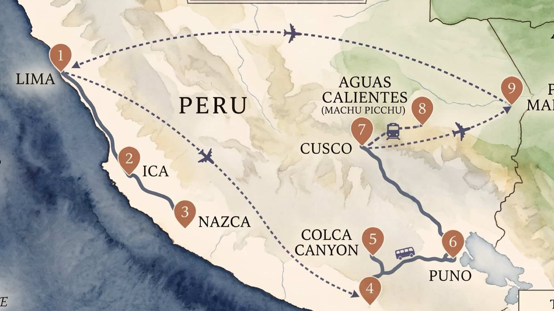
The expedition operates on a rigid tactical timeline driven by environmental variables. On the southern coast, movement begins across the gravel and dune fields of Paracas and Huacachina, where high-clearance 4x4 vehicles clear 30-degree sand faces before airborne survey in an eight-seater Cessna over the Nazca plateau. Aerial observation requires early morning departure to avoid afternoon thermals that render low-altitude flight unstable over the etched iron-oxide desert pavement.
From the coast, the route vectors inland to Arequipa at 2,325 meters for immediate physiological staging. The real test of mechanical and human endurance begins along the northward climb through the Patapampa Pass—topping out at 4,910 meters—where carburetors and lungs alike struggle for oxygen. Descending into Colca Canyon provides brief atmospheric relief before the long haul across the Altiplano past Laguna Lagunillas to Puno at 3,827 meters. Navigation of Lake Titicaca requires high-buoyancy vessels to cut through cold, high-density surface waters toward the totora-reed structures of the Uros and the stone terraces of Amantaní.
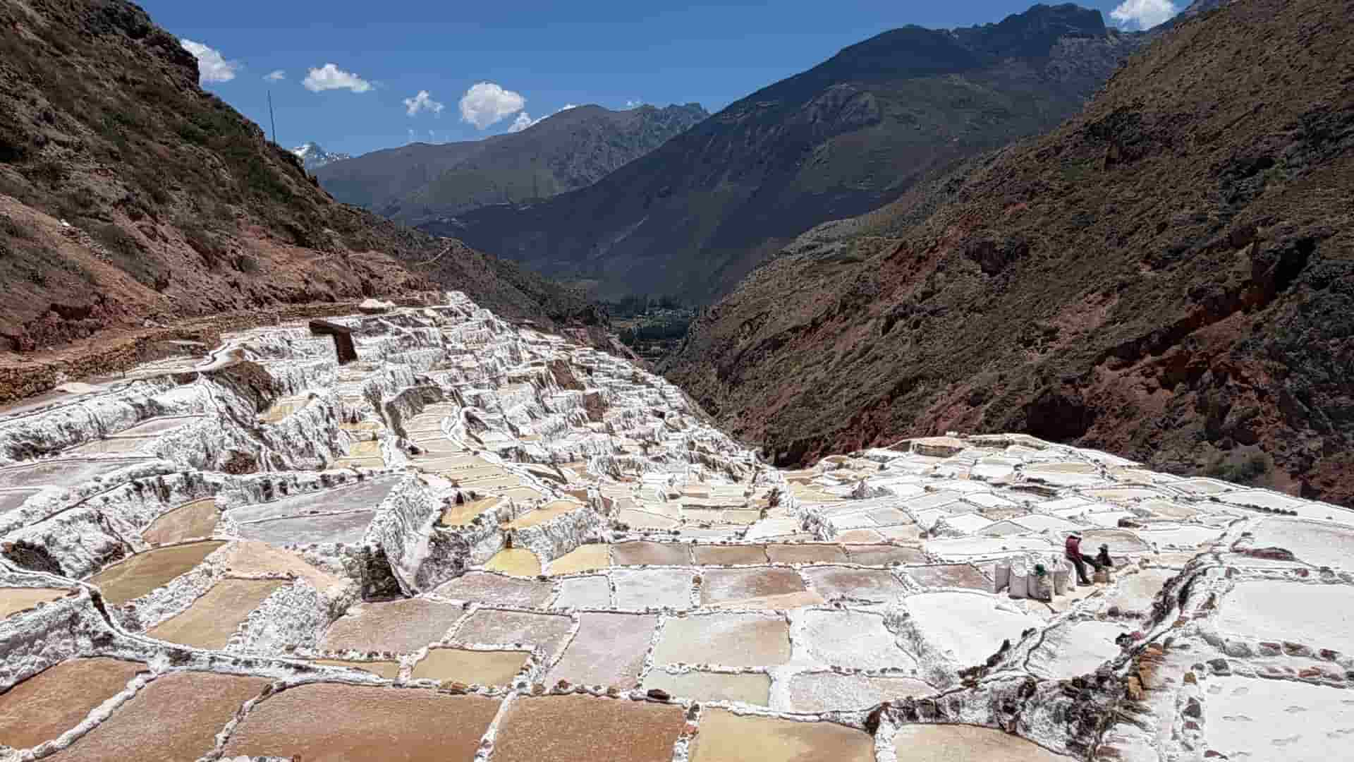
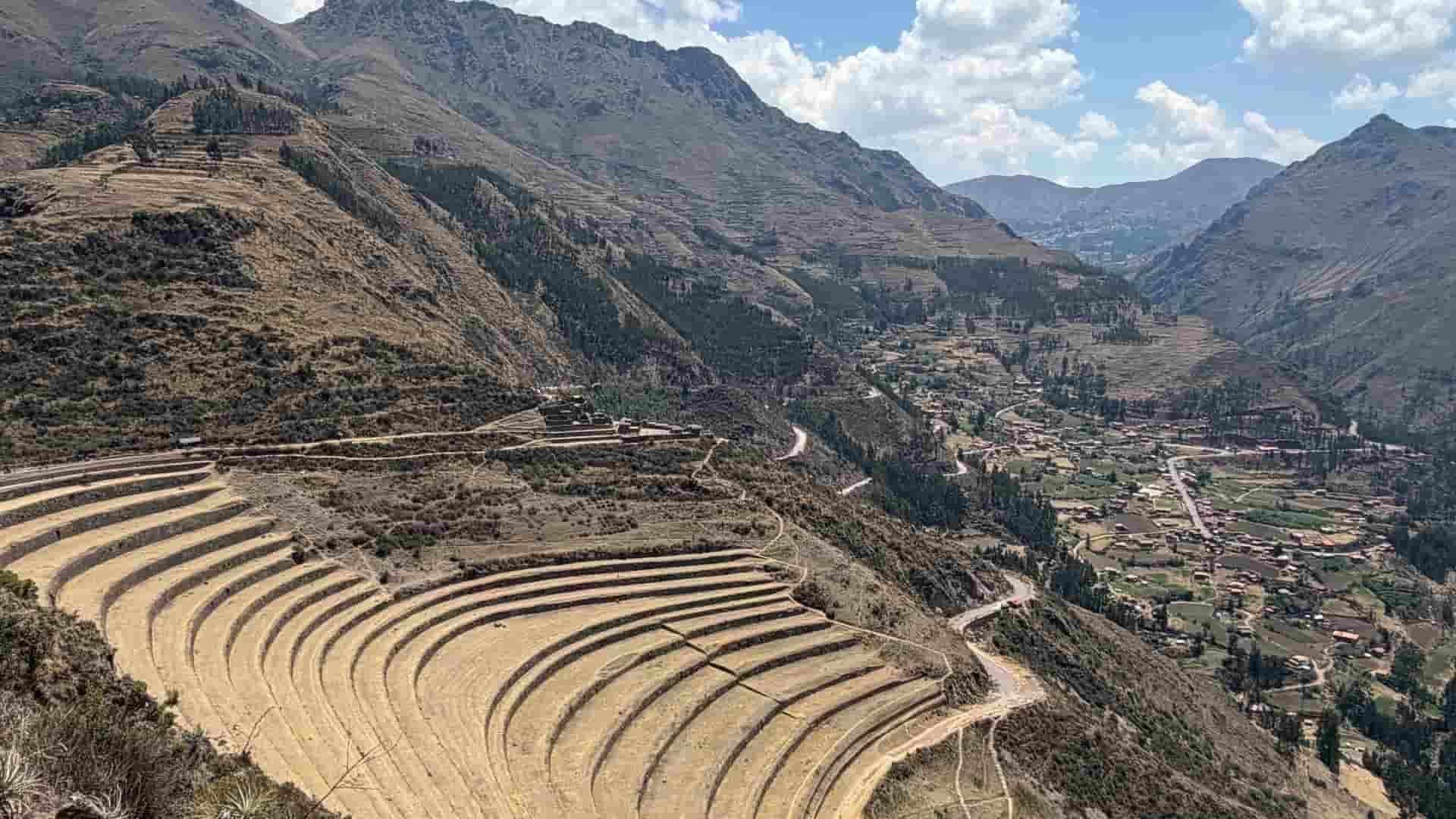
Logistical friction reaches its peak during the northern transit along the Ruta del Sol, crossing the watershed divide at La Raya Pass (4,335 meters) before descending into the Cusco basin. In the Sacred Valley, high-altitude trail work gives way to quad-bike tracks traversing the salt pans of Maras and the megalithic terraces of Ollantaytambo. The Vistadome rail transit along the foaming Urubamba River brings us to Aguas Calientes for the dawn ascent of Machu Picchu Circuit 1, where granite staircases test knees and cardiovascular output.
The final phase demands an abrupt biome shift: flying out of Cusco, dropping over 3,000 vertical meters into the thermal pressure chamber of Puerto Maldonado. Skiff transportation along the silt-laden Tambopata River replaces high-altitude transport, navigating oxbow lakes where humidity nears 100 percent and equipment requires constant protection against moisture degradation.
The Human & Cultural Echo
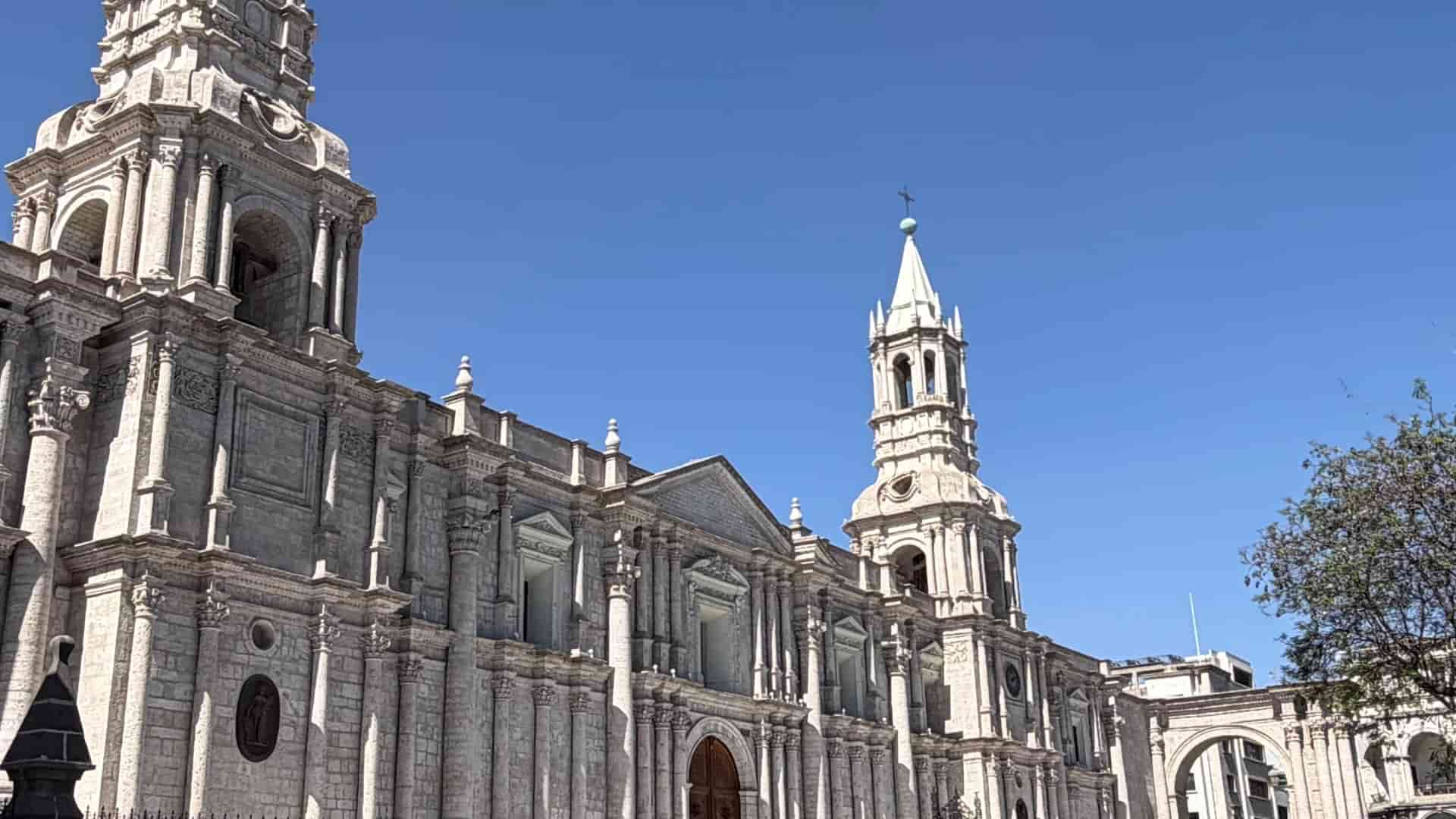
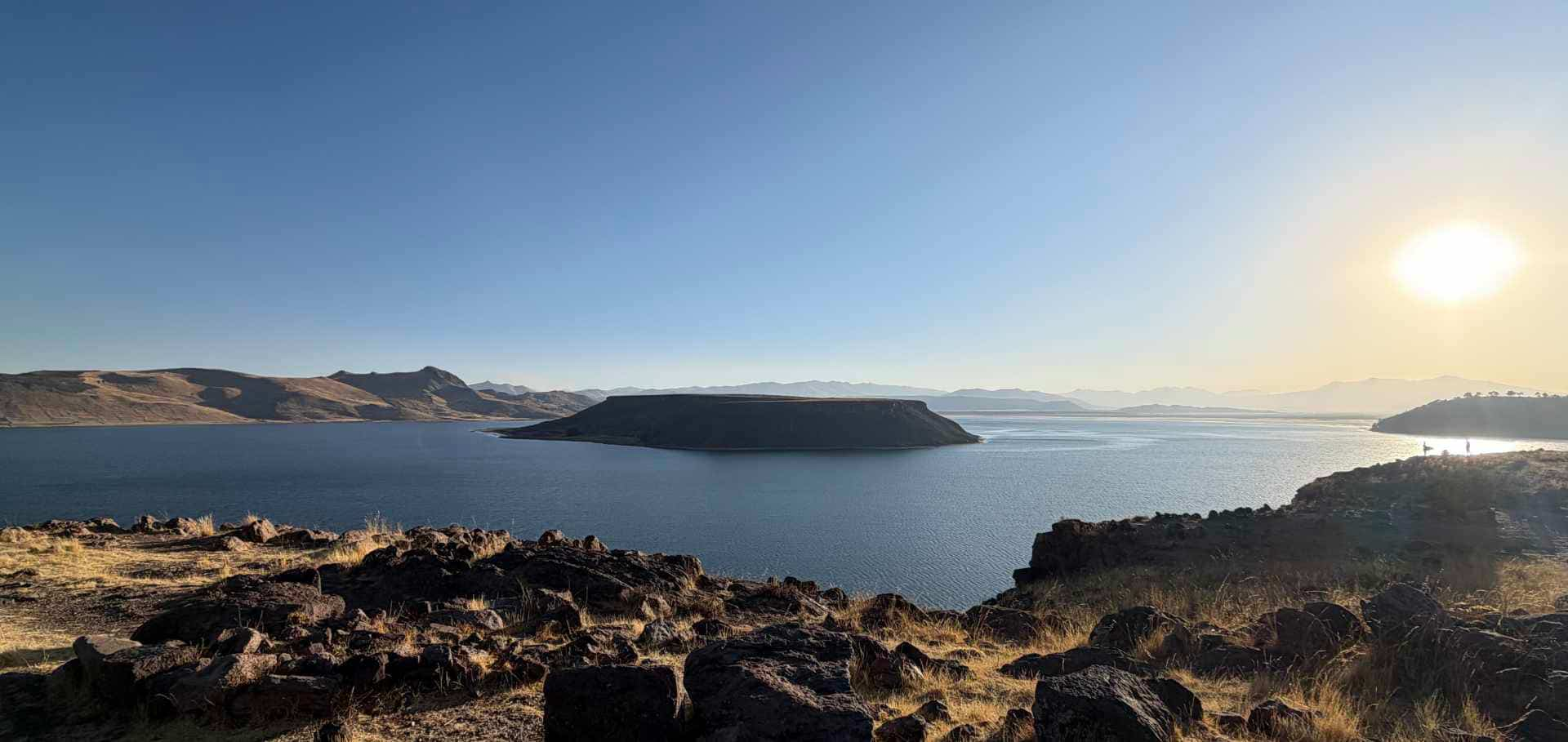
Human survival in these extreme ecosystems left behind an extraordinary structural record carved directly from the earth. In Arequipa, Spanish Baroque master builders utilized volcanic sillar—a white ignimbrite stone spewed from Misti volcano—creating fortress-like monasteries capable of absorbing seismic shockwaves. Further high on the altiplano, near the frozen margins of Laguna Umayo, the pre-Inca Colla culture erected the chullpas of Sillustani: towering basalt mortuary towers constructed with precise, outward-sloping polygonal masonry engineered to withstand relentless freeze-thaw cycles.
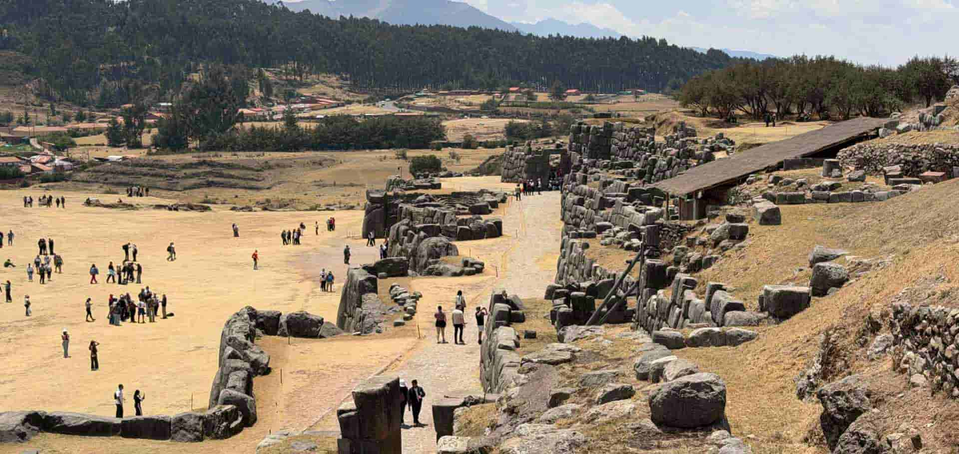
This stone mastery reached its zenith under Inca rule. At Qorikancha, Sacsayhuamán, and Ollantaytambo, massive mortarless granite blocks are fitted with sub-millimeter precision, allowing structures to dance during mega-earthquakes rather than fracture. These were not merely architectural feats, but sacred calibrations balancing human life with unforgiving geography. On Lake Titicaca, the living architecture of woven totora reeds demonstrates an equal mastery over aquatic ecology, while the pink terraced evaporation ponds of Maras reflect ancient hydraulic control, continuously harvesting salt from subterranean thermal springs just as they did under the Tawantinsuyu empire.
The Calibration & The Horizon
This traverse is no passive vacation; it is a violent physical re-centering. The cost is paid in depleted oxygen, salt-crusted skin, dust-choked throats, and muscle fatigue accumulated across three distinct ecosystems. Yet the dividend is absolute clarity. To move through this vertical land—to feel the sheer friction of the Andes grinding against the Pacific before collapsing into the Amazonian canopy—is to remember human insignificance. The mountains do not care for our exhaustion, nor the jungle for our endurance. We return recalibrated, our internal compass reset by the cold stone, thin air, and relentless wild forces of the high frontier.